The India Meteorological Department has forecast widespread showers from 5 to 9 January across Punjab, Haryana, Chandigarh, Delhi, north Rajasthan, west Uttar Pradesh
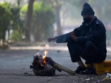
A man warms himself near a fire along an alley in New Delhi. The IMD has predicted rainfal across northwest and central India this week. AFP
First, it was the shivers and now it’s the rains. After a shivering cold wave, two consecutive western disturbances are likely to bring rainfall to parts of North India and central parts of India in the days to come.
Confused about what this means? Here’s a break-down:
Western disturbances explained
A western disturbance is an extratropical storm originating in the Mediterranean region that brings sudden winter rain to the northern parts of the Indian subcontinent.
Dr RM Saxena, a professional meteorologist at Skymet Weather defines a Western Disturbance as “a low-pressure area or a trough over the surface or the upper-air in the westerly winds regime, north of 20 degrees north, causing changes in pressure, wind pattern and temperature fields. It is accompanied by cloudiness, with or without precipitation.”
Indian meteorologists coined this term to describe the systems moving from the west to the east direction.
Skymet, a private Indian company, states that Western Disturbances originate in the Caspian Sea or the Mediterranean Sea as extra-tropical cyclones. They gradually travel across the middle-east from Iran, Afghanistan and Pakistan to enter the Indian sub-continent.
Western Disturbances are at their peak in January and February and are considered important for the development of rabi crops in the Northern subcontinent.
The Western Disturbances are not always the harbingers of good weather. Sometimes, they can cause extreme weather events like floods, flash floods, landslides, dust storms, hail storms and cold waves killing people, destroying infrastructure and impacting livelihoods.
How will the two Western Disturbances affect India?
The India Meteorological Department (IMD) on Sunday reported that two Western Disturbances would affect the weather, bringing rainfall to parts of India.
Meteorologists noted on Monday that the year’s first Western Disturbance over the Arabian Peninsula would most likely trigger widespread rainfall across the Western Himalayan Region until 7 January. It is also expected to produce scattered to fairly widespread rain over Delhi, Punjab, Haryana, north Rajasthan, and Uttar Pradesh from Wednesday onwards.
Accordingly, the IMD kept Jammu and Kashmir, Ladakh, and Himachal Pradesh under an orange alert for Tuesday and Wednesday as forecasts suggest isolated heavy rains.
Further, an intense Western Disturbance is set to affect the region later this week, from 7 January onwards. Under its influence, rain and snowfall are expected to increase across the Western Himalayan Region from Friday to Sunday, with isolated heavy falls on Saturday.
Weather experts stated that isolated hailstorms may hit Jammu-Kashmir-Ladakh, Himachal Pradesh and over Uttarakhand.
“We are expecting widespread rains over northwest India and parts of central India till 9 January with chances of heavy rain on 5 and 6 January and 8-9 January. Due to two intense western disturbances back to back, day temperatures may be lower than normal and there is likely to be an overcast sky. Night temperatures are likely to be above normal.
There is likely to be widespread rain over Delhi also on 5 January and 7 January. Due to the effect of the second disturbance, there will be rainfall and hailstorm in Telangana, Vidarbha, Chhattisgarh and Jharkhand also,” RK Jenamani, senior scientist, national weather forecasting centre at IMD, was quoted as saying.
With inputs from agencies
Read all the Latest News, Trending News, Cricket News, Bollywood News,
India News and Entertainment News here. Follow us on Facebook, Twitter and Instagram.

